Book Appointment Now

Smith River Salmon Fishing: Seasons, Spots, and Smart Tactics
ByIMRAN
Eighteen miles of dam-free, Wild and Scenic water in far northwestern California funnel king salmon into the system from late August through November, and a short, tightly regulated coho window overlaps that late-fall push. Clear green water, fresh-fall storms, and a 40-mile road network threading the Smith River National Recreation Area decide where, when, and how you fish. Regulations change by the week, so cross-checking the current California Department of Fish and Wildlife (CDFW) quota table and the Del Norte County fish-count weir before locking in dates is non-negotiable.
This article covers how to plan a Smith River salmon trip, from matching run timing on the North, Middle, and South forks to sorting CDFW rules and picking gear for the system’s famously clear water.
A Wild River at the Edge of California
No dam regulates the Smith, and that single fact shapes almost every decision you make. Flows rise and fall with rainfall, salinity pulses move up the estuary, and adult salmon cue to fresh water rather than to scheduled releases. The Smith River National Recreation Area, managed by Six Rivers National Forest, protects roughly 320 miles of river and stream corridor, keeping the water cool, shaded, and largely free of agricultural drawdown.
Average annual rainfall along the North Coast runs 70 to 90 inches, and the river can climb from 4,000 cubic feet per second (cfs) on a summer afternoon to more than 50,000 cfs during a December atmospheric river. That volatility means bank-friendly wading in August and treacherous, debris-choked chocolate water by December.
Three Salmonids, One Drainage
Fall-run Chinook, also called king salmon, are the primary target and typically dominate angler effort. They enter from late August through mid-November, with most brood years showing a bimodal pattern: an early pulse of smaller river fish in September, followed by larger, more chrome-bright adults after the first big rains of mid-October.
Coho salmon appear in smaller numbers, often as a bycatch bonus during king season. A short, conservative retention window exists, and the fish that arrive tend to be bright, feisty, and small. Wild steelhead follow a winter-and-spring life cycle, and while some incidental encounters happen, the Smith is not a winter steelhead destination in the way the Klamath or Rogue systems are.
Juvenile salmonids spend one to two years in fresh water before smolting, so protecting redds in gravel beds matters as much as catching adults. Heavy rain triggers spawning migrations, but it also redds up freshly disturbed gravel, which is why CDFW often delays openings after major storms.
Why Pre-Trip Planning Carries the Day
Cell service dies within minutes of leaving Crescent City, and the road between Hiouchi, Gasquet, and the upper forks sees washouts most winters. A single missed detail, such as a closed launch ramp, a tribal boundary you didn’t see, or a quota that filled overnight, can turn a 12-hour drive into a skunk. The anglers who consistently score on the Smith plan their week around water level, weather, and current regulations before they ever tie a knot.
Reading the Run-Timing Calendar
Annual fish-count weir data on the lower river shows the run shifting by weeks from one year to the next, and the variable driving those swings is rainfall, not the printed calendar. Preseason forecasts from the California Department of Fish and Wildlife project run size by April, but actual entry numbers update weekly once fish start moving.
For current conditions, the Klamath River fall Chinook indicator and the Smith River weir count together tell you whether fresh fish are entering. A sudden jump at the weir, paired with a 1.5- to 2.5-foot rise on the gauge, signals a fresh push that often lights up the lower river within 48 hours.
Early-Fall Kings: Late August Through Mid-October
Early-entry kings tend to run 8 to 18 pounds, hold in the deeper summer holes, and respond well to drifted roe, back-bounced plugs, and rolled spinnerbaits worked tight to structure. Water is at its clearest, so heavier leaders and natural-toned plugs outperform bright hardware.
This window favors anglers who can wade-fish deep seams and tailouts before the first big storm dirties the water. On dry years, the early run can be the best shot at a fresh king, particularly on the Middle Fork above the South Fork confluence.
Late-Fall Kings and the Coho Overlap
The first major Pacific storm of October usually triggers a much larger migration, with fish in the 15- to 35-pound range showing alongside a smaller but consistent coho presence. Coho retention is allowed only on announced dates with reduced daily bag limits, and many king anglers treat them as a deliberate release to protect brood stock.
Because the bulk of the run enters within a 10- to 14-day window after the first hard rain, the late season rewards flexibility. A 4-day storm window with falling, clearing water often produces the highest catch rates of the year.
Cross-Checking the Data Before You Book
- Check the gauge daily: USGS gauge 11532500 (Smith River near Crescent City) reports cfs and stage in real time.
- Read the weir count: CDFW posts weekly Smith River weir counts from late August through November.
- Track the Klamath index: The Klamath fall Chinook forecast is the best early indicator of Sacramento and coastal run strength.
- Watch the rainfall map: 2 to 4 inches of rain over 48 hours typically triggers a fresh push.
- Verify openings: CDFW issues in-season bulletins that can change the section or the quota within a day.
Sorting the Rules Before You Cast
California’s North Coast salmon regulations are quota-driven, meaning the season can close mid-week once the projected take is reached. The 2024 and 2025 seasons have both opened under a May 1 preseason structure with weekly updates, and the Klamath River system, which shares management with the Smith, has historically been the gating factor.
Before you load the truck, confirm three things: that the river is open for the section you plan to fish, that the current week’s quota has not been reached, and that your paperwork is current. Failing any one of those means a long, legal drive home with empty hands.
Licenses, Validations, and Report Cards
Every angler 16 and older needs a valid California sport fishing license and a current year’s Salmon/Steelhead Report Card, sold separately. Additional requirements apply in some years:
- North Coast Salmon Report Card: Required when fishing the Smith, Klamath, and Trinity systems during the quota-managed season.
- Second-Rod Validation: Available for an extra fee; useful for covering water faster with two setups.
- Ocean Enhancement Validation: Required for any angler targeting salmon in adjacent ocean waters.
- Steelhead Report Card: Needed if fishing outside the salmon window for winter steelhead.
Report cards must be returned to CDFW by January 31, even if you didn’t fish. Skipping the return triggers a non-refundable fee on next year’s license and a hold on your account.
Quota Mechanics and In-Season Closures
The preseason quota table splits the Klamath management zone, including the Smith, into river-specific allowances. Once the projected harvest is met, the section closes until the next scheduled opening or the end of the season. Closures happen mid-week, often with 24 to 48 hours of public notice, so checking the CDFW newsroom the morning you drive in is essential.
The Smith has historically carried a smaller share of the overall quota than the Klamath, meaning in-season closures hit the Smith before the Klamath itself. Treat any week you plan to fish as conditional, and have a backup river (the lower Klamath or the Trinity) ready in case the Smith closes.
Coho Retention and Handling
Anglers are typically allowed one coho per day with a 24-inch minimum fork length and a possession limit of two when the retention window is open. Most coho are encountered incidentally while fishing for kings, and CDFW asks that you land them quickly, photograph them without removing from water when possible, and revive them before release if not harvested.
Non-target coho caught outside the retention window must be released. Pinching the lower jaw with bare hands or using a rubberized glove, rather than gripping the body, protects the slime layer and improves post-release survival.
Barbless Hooks and Tackle Restrictions
Wild-salmon regulations require barbless hooks in most sections, with single-point barbless preferred and inline circle hooks mandatory when fishing bait in some areas. Treble hooks on plugs must be replaced with barbless singles or two-sixtieths-inch barbless trebles. Tackle restrictions are easy to overlook because they don’t affect the cast, but a warden checking the plug box will notice.
Carry a pair of needle-nose pliers and a few spare barbless hooks in your vest. A 30-second swap on the riverbank keeps you legal when the rule changes mid-trip.
Mapping Access Across the Forks and Main Stem
The Smith splits into three forks above Hiouchi: the Middle Fork, the South Fork, and the North Fork. Each fork has its own character, its own access roads, and its own pressure pattern. Most public access is along the South Fork, where the Smith River National Recreation Area maintains several developed sites.
Lower-river access near the Highway 101 bridge and the Rowdy Creek area tends to be crowded during the early run, while the Middle Fork above the South Fork confluence sees lighter pressure and more holdable water. Knowing which fork fits your mobility and your timing saves hours of scouting.
Main-Stem and Hiouchi Access
The main stem below the forks sees the heaviest pressure but also the largest concentrations of early-run kings staging near the estuary. Public access exists at the Hiouchi Bridge, the county park near the community of Hiouchi, and along the South Fork Road pullouts. Bank-fishing here is productive in low light, but visibility issues and tribal land boundaries along the lower river catch visitors off guard.
The Hiouchi flats include private and tribal parcels that are not always signed. When in doubt, stay above the marked boundary line, fish from public access points, and never cross a fence or a sign.
Drift-Boat Ramps and Walk-In Spots
Drift boat fishing dominates the upper-river fishery because the deep, clear pools read like a postcard from the oar frame. Key access points:
| Access Point | Best For | Notes |
|---|---|---|
| South Fork Boat Ramp (above Gasquet) | Drift boats, sleds | Gravel ramp; reliable launch at flows under 6,000 cfs |
| Middle Fork Bridge (Patrick Creek area) | Walk-in, wade | Limited parking; deep holding water below the bridge |
| North Fork at Gasquet | Wade, short sled floats | Tight access; check with Six Rivers NF for closures |
| Hiouchi Bridge | Bank, sled put-in | Best in early fall; watch for posted private land upstream |
| Rowdy Creek (lower river) | Bank, walk-in | Heavy pressure during the late-fall push; arrive early |
At flows above 8,000 cfs, most walk-in access becomes unsafe for wading and drift boats take over. Sled fishing with small aluminum boats pushed with oars works on the South Fork at moderate flows and is the budget-friendly alternative to a full drift-boat setup.
Guide Versus Self-Route
A local guide is worth the cost on a first trip because the river reads differently than typical coastal salmon systems. Guides know which holes hold fish at each stage of the run, where the boundary lines fall, and what the bite looked like yesterday. For an angler with a single weekend, a guide compresses the learning curve and avoids the most common access mistakes.
Self-routing makes sense on a return trip once you’ve fished the section at least once, or for wade anglers who already know the South Fork’s structure. The river rewards repeat visits because each fork behaves differently from week to week, and a second day on the water often produces more fish than the first.
Gear and Presentations Tuned to Clear, Deep Water
The Smith’s clarity sets the technical bar higher than most California salmon rivers. Plug colors need to show up without flashing, leaders need to be heavy enough to turn a 30-pound king but light enough to entice a pressured fish, and presentations need to track tight to the bottom in water that often runs 6 to 12 feet deep.
Tackle choice in clear water is more about what the fish can see than what you can throw. A 30-pound king in 8 feet of gin-clear water has time to inspect a 25-pound leader for 2 full seconds before committing, which is plenty of time to reject anything that looks unnatural.
Plug Colors and Sizes
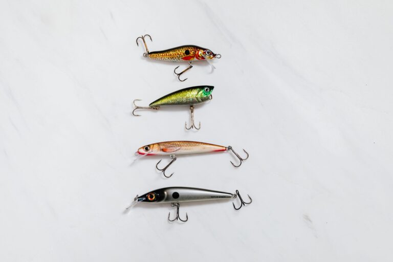
The classic Smith River plug selection runs 3.0 to 4.5 inches, with the larger sizes taking over as the run thickens in October. Color choices that consistently produce include:
- Pink with white belly: The most consistent producer in clear water across early and late runs.
- Chartreuse with black back: Triggers in off-color or stained water after a fresh rain.
- Blue and silver with a sparse dot pattern: Imitates baitfish in the lower river and estuary.
- Solid purple or dark green: A low-light producer for dawn and dusk sessions.
- Natural baitfish pattern: Scaled silver, 3-inch profile, tight wobble; underfished and underrated.
One mistake to avoid: overloading the spread with bright hardware on sunny days. The Smith punishes unnatural flash more than most rivers, so reduce or eliminate reflective tape on the underbelly when the sun is high.
Spinners and Roving Tackle
Spinner sizes for the Smith typically range from 4.5 to 5.5 inches overall length. Brass and copper blades in sizes 3 to 4 catch the most fish in stained water, while silver and polished blades outperform in low-light or early-morning conditions. Blue, chartreuse, and chartreuse-with-pink-saddle skirts cover most situations.
Spinners shine in the upper sections of the forks where wade-fishers can cover water methodically. A 4.5-inch spinner worked 60 to 80 feet downstream, with a steady retrieve and occasional hesitations, outfishes a faster reel in most cases.
Roe Bags, Divers, and Bobber Rigs
Drift fishing with roe remains the most consistent king-salmon producer on the Smith, particularly in the deeper tailouts and glide pools. Standard setup:
- Egg loop: A 12- to 18-inch leader of 12- to 20-pound mono, tied to a size 1 to 2/0 baitholder or octopus hook.
- Roe bag: Cured salmon roe, packed loosely, and wrapped in pink or red mesh for scent dispersal.
- Sinker weight: 1 to 2.5 ounces, sized to hold bottom at the chosen drift speed.
- Bobber rig: 6 to 10 feet below a fixed bobber, used in the slowest seams where drift speed is already low.
- Diver setup: In-line divers like a Jet Diver or a Kwikfish allow a long leader in faster water without rolling the bait.
When the bite is light, a chunk of cured roe paired with a sand shrimp tail outperforms roe alone. The combination produces scent and visual cues that drive a higher hookup rate in pressured water.
Hooking, Fighting, and Releasing Wild Kings
Wild kings fight hard in fast current, and a long fight in warm water cuts release survival. Use a 9- to 10-foot graphite rod rated 15 to 30 pounds, paired with a baitcasting reel holding 200 yards of 30- to 50-pound braid and a 25- to 40-pound fluorocarbon leader. Keep the drag set so a 25-pound fish can run for 30 to 60 seconds without burning line.
Net the fish quickly, keep it in the water while you remove the hook, and revive it head-first into the current until it kicks free on its own. A 60-second hold in moving water increases post-release survival measurably, especially in the warmer pools of the lower river.
Finessing the catch matters, but releasing it properly is what keeps the river fishing for decades to come.
Putting the Trip Together Without the Guesswork
The Smith’s remoteness is its appeal and its biggest planning hurdle. Crescent City, the closest commercial hub, sits 30 minutes from the lower river, while Gasquet and Hiouchi offer only basic supplies. Plan fuel, food, and ice before you turn off Highway 199.
Most anglers budget three days and two nights to allow for weather, water-level changes, and an in-season closure buffer. A single long weekend produces inconsistent results because the river rewards flexibility.
Base Camps and Logistics
- Crescent City: Full-service lodging, fuel, grocery, tackle shops, and the closest hospital (Sutter Coast).
- Hiouchi: One small motel, a cafe, and basic tackle. Useful base for the lower-river access.
- Gasquet: Limited lodging, a general store, and a cafe. Best base for the Middle Fork and South Fork.
- Camping: Panther Flat, Grassy Flat, and Patrick Creek campgrounds inside Six Rivers NF. Reserve in advance for the September–November window.
- Fuel: Last reliable stations in Crescent City and Gasquet. Top off before heading up the Middle Fork.
Weather, Flow, and Float Windows
The best float windows come after a storm front passes and the river drops 1 to 2 feet from peak. Falling, clearing water within 24 to 72 hours of a 2- to 4-inch rain event produces the strongest bite. Stable, low water in late October often produces better wade-fishing than float-fishing because the river runs clear and fish hold tight.
At flows above 10,000 cfs, most walk-in access closes for safety, and only experienced drift-boat operators should be on the water. Below 2,000 cfs in late season, the upper forks fish well on foot but the lower river crowds and warms, often shutting the bite down by midday.
Final Pre-Trip Checklist
Run through this list the night before you drive in. Most Smith trips fail because one item is missing, not because the fishing is bad.
- License and report card: Current year, signed, with North Coast Salmon Card if required.
- Barbless, legal tackle: Plugs re-rigged, circle hooks for bait, pliers for in-rig swap.
- Flow and weather check: Gauge under 8,000 cfs for wading, 4,000 to 6,000 cfs for a comfortable drift.
- Quota status: CDFW newsroom for the current week’s opening and any closure notice.
- Access map: Six Rivers NF map with private and tribal boundaries highlighted.
- Fuel, ice, food: Topped off; bring a day cooler because lodging options are limited.
- Exit timing: Plan a 6 a.m. departure for a 4-hour drive, allowing on-water time by 10 a.m.
Bottom Line
The Smith rewards anglers who treat planning as half the sport. A dam-free, Wild and Scenic river with weekly quota changes and rainfall-driven runs is not a destination you can shortcut, and the best trips blend current data, conservative tackle choices, and respect for tribal and private boundaries. Show up with the right license, the right plugs, and the right flow window, and the long drive from anywhere in California pays back in chrome kings and clean water.
FAQ
When is the best time to fish the Smith River for salmon?
Late September through mid-November covers the bulk of the run, with the first major October storm usually triggering the largest push. The first 48 to 72 hours after a 2- to 4-inch rain event, on a falling river, produces the highest catch rates for fall-run Chinook salmon.
Do you need a guide to fish the Smith River?
A guide is strongly recommended for first-time visitors because access, tribal boundaries, and seasonal regulations are not always obvious from a map. Self-routing is reasonable for return trips and wade anglers who already know one of the forks.
What kind of salmon are in the Smith River?
Fall-run Chinook (king) salmon are the primary target, with a small, regulated coho run that overlaps the late kings. Wild steelhead are present but are not the focus of the fall salmon season.
Is the Smith River open for salmon fishing this year?
The river is typically open from the Saturday nearest September 1 through mid-November, with a quota-driven structure that can shorten the season. Check the CDFW newsroom the morning of your trip for the current week’s status.
What flies work best for Smith River salmon fishing?
Smith River salmon anglers primarily use plugs, spinners, and roe, but fly anglers can produce on swung leech patterns, intruder-style two-handed flies, and egg-sucking leeches in purple, pink, and black. Heavier 8- to 10-weight rods and sink-tip lines cover the deeper pools.
Where do you access the Smith River for salmon fishing?
Main-stem access is best from the Hiouchi Bridge and the South Fork Road pullouts, while the Middle Fork and South Fork above Gasquet offer walk-in and drift-boat access. Stay above the marked tribal and private boundaries along the lower river and Hiouchi flats.