Book Appointment Now

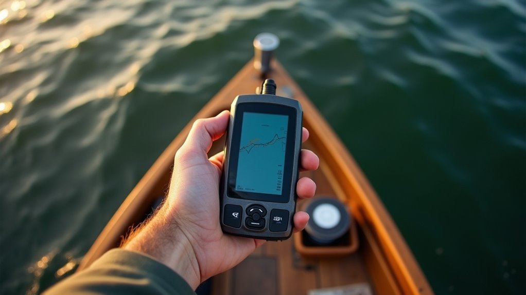
GPS Fishing Spots: Save Productive Locations
Saving GPS fishing spots boosts your catch rate by letting you return to proven locations. Pick a GPS unit that fits your budget and fishing style, then mark only spots that consistently produce bites. Record depth, structure, and bait, and use clear names and color codes for quick retrieval. Plan routes with tracks, combine sonar with maps, and back up and share waypoints so your crew can find them again.
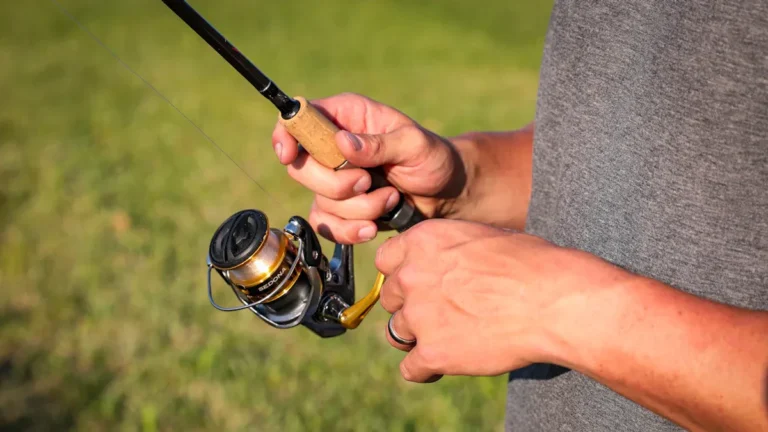
Choose a Fishing GPS Unit (Features vs. Budget)
Whenever you’re picking a fishing GPS, consider about what you’ll actually use it for and how much you’re willing to spend, because that balance will shape every choice you make. You want gear that feels like it belongs to your crew, so weigh battery life against the time you spend on water.
Reflect on display size for readability in sun and waves, and how touchscreen sensitivity holds up whenever your hands are wet or gloved. Update frequency matters too since charts and firmware affect accuracy.
Choose a model that matches your outings, whether short trips or long scouting days. Compare interfaces, mounting options, and map compatibility.
Talk with fellow anglers, try units whenever you can, and pick what fits your budget and team.
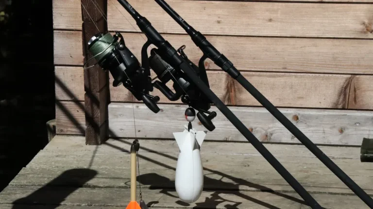
Mark Waypoints That Actually Repeat Bites : Step‑by‑Step
Start through considering like the fish and not the map reader; you want waypoints that bring back bites, not just locations that look good on paper.
You’ll mark spots once sonar shows active fish, consistent depth, and structure. Record bait selection that worked and the time of day so you can repeat the feed.
Use slow passes and fan patterns while logging tracks, then drop pins where fish actually bite, not where you believe they should. Try different trolling techniques nearby and mark variations that produce hits.
Add depth, bottom type, and current notes to each waypoint to make them usable later. Share with your crew to build trust and keep spots alive.
You’ll return with confidence and repeatable success.
Name & Tag Waypoints for Fast Retrieval
If you desire to get back to the fish fast, naming and tagging your waypoints the right way will save you time and frustration on every trip.
You’ll want consistent names that tell you depth, structure, or species at a glance. Use short prefixes like 10ft, Reef, or Bass so labels sort neatly. Then apply color coding to group similar spots visually. Pick colors for structure, bait, or seasonal bites.
Add custom icons for specific tactics like trolling, anchor, or dropper loop. Keep reminders in each waypoint with date, lure, and water temp so the memory stays fresh.
Sync and back up your list so the team can share. Small clear systems make everyone feel included and confident on the water.
Plan Routes and Drifts With Tracks
Plot your track before you cruise and you’ll save time, catch more fish, and feel more confident on the water. You’ll lay down tracks to evaluate drift patterns and practice route optimization so each run feels familiar and friendly.
Save tracks near waypoints and you’ll return to the same current seams and edges that produced bites. Sharing tracks with your crew builds trust and keeps everyone included.
- Record multiple runs to compare speed and drift patterns under varied wind
- Use tracks to set start and end points for repeatable drifts
- Mark safe corridors and shallow hazards for confident route optimization
- Sync tracks with your map groups so friends can follow a proven path
These steps make your outings calmer, clearer, and more connected.
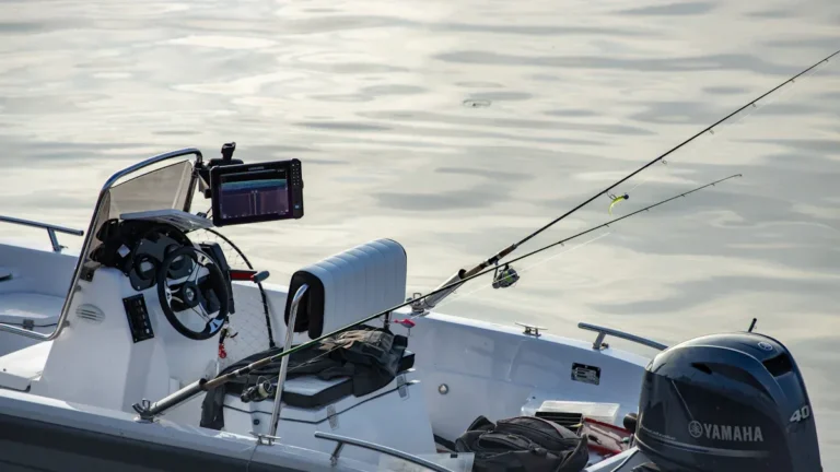
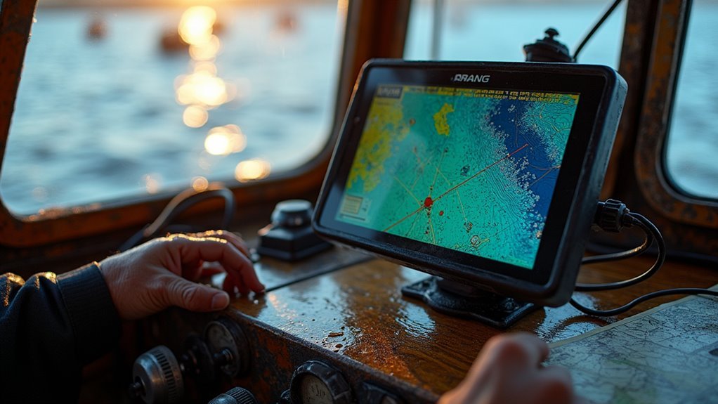
Use Sonar, Depth Maps & Satellite Charts Together
You’ll get better results whenever you align your sonar readouts with depth maps so the fish blips match real underwater contours.
Crosscheck those contours against satellite charts to confirm structure and spot shallow shelves, drop-offs, or concealed humps.
Then mark the confirmed structure on your maps so you can return with confidence and share clear observations for future trips.
Align Sonar With Charts
Once you combine sonar returns with depth maps and satellite charts, the water below starts to make sense and you’ll feel more confident finding fish. You want your screens to tell the same story, so initially calibrate sensors and check overlay accuracy. That builds trust in every waypoint you save and share with friends who belong to your crew.
- Match sonar depth readings to chart contours while idling so you can spot errors fast.
- Adjust GPS offset and sonar scroll speed to line up structure echoes with map features.
- Use satellite texture to confirm weedlines and shallow flats that sonar marks.
- Recheck calibrations after moving to new waters or whenever conditions change.
These steps make your team relaxed, effective, and connected on the water.
Crosscheck Depth Contours
Now that your sonar and charts are lined up, it’s smart to crosscheck depth contours using all your tools so you trust every mark you save. You want to verify soundings from your fish finder against depth maps and satellite charts.
Start upon pausing over a contour change, record the sonar number, then compare readings on the chart. In case they match, you can save the waypoint with confidence.
Should they differ, sweep slowly, take multiple passes, and check for local variations like weed beds or sediment.
You belong with others who care about accuracy, so share uncertain spots for a second opinion. Keep records with dates and conditions, update maps whenever needed, and keep verifying so your saved spots stay reliable.
Mark Structure On Maps
At the time you’re marking structure on your maps, use sonar, depth maps, and satellite charts together so you get a clear image of what’s below and around you. You and your fishing partners will trust one another as you share clean waypoints that reflect true map accuracy and real underwater structure.
Start initially with confirming contour lines with sonar readings. Then overlay satellite detail to spot visible shore and weed edges. Finally save a labeled waypoint with depth observations.
- Crosscheck sonar arches with depth maps for accurate placement
- Add satellite cues like rock shadows or vegetation lines
- Tag waypoints with depth, bottom type, and date
- Share grouped spots with friends for collective learning
This approach builds confidence, belonging, and better trips for everyone.
Back Up, Sync, and Share Your Waypoints
You’ll want to back up your waypoints as soon as you create them so a lost device or accidental reset doesn’t erase your best spots.
Syncing across devices keeps your boat, phone, and tablet all on the same page and lets you plan or share routes from wherever you are.
Start a simple routine of exporting waypoints, using cloud sync whenever available, and checking backups before each trip so you never lose a hard-earned location.
Backup Your Waypoints
Protect your hard-earned spots through backing up and syncing your waypoints so a lost device or bad weather won’t wipe out your best fishing memories. You want simple, reliable habits that keep the crew connected and your spots safe.
Use manual logging as a baseline and add digital copies for waypoint redundancy. That way you and your mates all feel secure.
- Export waypoints to a GPX or CSV file and store on a USB or cloud account you trust
- Keep a dated paper log in the tackle box with key remarks and quick directions
- Periodically copy files to a second storage location for extra safety
- Share a limited list with close friends so everyone can find the spots and respect them
These steps build trust, reduce anxiety, and keep your group fishing together.
Sync Across Devices
Because losing a favorite spot hurts, syncing your waypoints across devices gives you peace of mind and keeps everyone on the same page. You’ll want to enable cloud storage in your GPS app so waypoints save automatically.
Turn on sync settings and pick which folders or groups to share with friends or family. Whenever you update a reminder or move a marker the change appears on every device. That means your crew sees the same drops, contours, and reminders during a trip.
Use folders for structure types and labels for depth to keep things tidy. Verify sync settings before you head out and confirm backups completed. Provided someone adds a new productive spot you’ll all get it fast and feel connected.
Add Seasonal & Weather Notes to Each Waypoint
Once weather and seasons change, your favorite waypoints can tell a very different story, so add seasonal and weather observations right away to keep them useful year round. You’ll build a trusted log that links weather patterns with fish behavior and seasonal migration.
Record wind, barometer swings, water temp, and where fish moved that day. That helps you and your crew feel confident on future trips.
- Record date, wind direction, and cloud cover for each waypoint
- Document water temperature, currents, and baitfish presence where you saw activity
- Mark seasonal migration timing for species and any repeatable patterns
- Add quick photos or sonar snapshots to show conditions you want to revisit
You’re creating a shared map that welcomes others to learn and belong.
Frequently Asked Questions
Can I Hide Waypoint Coordinates From Others Permanently?
Yes - you can hide them. (Imagine a locked folder icon.) You’ll use privacy settings and coordinate encryption where available, and won’t share exports; lean on trusted groups, so your secret spots stay protected and you feel part of a careful community.
How Do I Recover Waypoints From a Damaged GPS Unit?
You’ll try data extraction via USB/SD card, use the manufacturer’s firmware recovery tools, or contact support for service; provided community forums offer trusted steps, you’ll follow guides together to restore waypoints and share successes.
Are There Legal Restrictions Sharing Private Fishing Spot Coordinates?
Yes - you can, but local laws and private property rules might limit sharing; envision a protected cove flooded through strangers. Respect privacy concerns and data ownership, and coordinate with your fishing community to protect treasured spots.
Can I Use Waypoints for Ice Fishing or Only Open-Water?
Yes - you can use waypoints for ice fishing, and they’ll help mark holes, structure, and safety routes; just prioritize ice safety, sync waypoints across devices with waypoint syncing, and share spots only with trusted peers.
How Accurate Are Waypoint Depths After Major Storms?
“Measure twice, cut once.” You’ll see significant depth variance after storms; waypoint depths can shift. You’ll want regular sonar calibration and re-surveys, and your crew’s shared logs will help everyone stay confident and connected on productive spots.